

Geography fieldwork – How to make it effective
Gather your maps and head outside to give pupils a meaningful geography experience they won’t soon forget…
- by Teachwire
- Classroom expertise and free resources for teachers
If there’s one place a geography teacher should let their enthusiasm for their subject run wild, it’s during geography fieldwork.
Your enthusiasm for investigating the geography that surrounds us can be infectious, and provide an important spark for your pupils’ interest in our subject.
So, what are the crucial ingredients and processes that produce effective geography fieldwork? Join us as we find out…
What is geography fieldwork?
Fieldwork is one of geography’s key elements. As Dr David Lambert, one of my predecessors at the Geographical Association, once wrote, “It is absolutely essential… It expresses a commitment to exploration and enquiry, and geography’s concern to discover and to be curious about the world.”
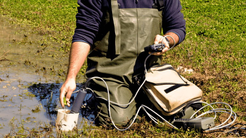
Geography fieldwork can take place in a school’s grounds, local area, elsewhere in the UK or further afield. Regardless of location, duration or setting, geography fieldwork helps young people apply their geographical understanding and skills to better understand the real-world interrelationships between people and their environment.
Geography fieldwork under pressure
A 2023 Teacher Tapp survey of secondary teachers found that 40% reported seeing reductions in their geography fieldwork since Covid.
Additionally, Ofsted has identified that fieldwork is ‘underdeveloped’ in almost all schools, rarely extending beyond the requirements of exam specifications, with little differentiation between a ‘field trip’ and geography fieldwork.
A focus on the latter is what will deliver the greatest impact on the ability of pupils to think – and work – like geographers.
Difference between fieldwork and field trips
So what exactly elevates geography fieldwork beyond simply ‘visiting’ a place? The answer lies in fieldwork’s emphasis on geographical enquiry.
As geographer Dr Margaret Roberts notes, there are a series of key questions through which you can frame your fieldwork:
- Where…?
- What…?
- When…?
- What ought…?
- What might…?
- Who…?
- Why…?
- How…?
You’ll also need to carefully consider precisely where your geography fieldwork should take place and why.
What location will best support the learning you want your pupils to achieve, and what are the cost and time implications of organising a visit there?
“What location will best support the learning you want your pupils to achieve?”
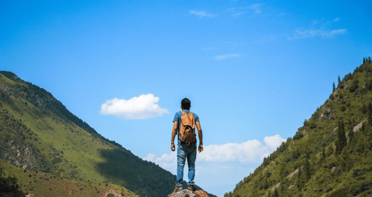
If your school (and your students’ parents) are willing and able to organise a first-hand experience of tectonic processes for your pupils, Iceland may well be the perfect location.
If, however, you want to explore flood risk, then you might not need to expend the costs and time required to travel to an iconic geography fieldwork site.
Conducting geography fieldwork at a local river will be cost-effective, and could even be more relevant (especially since 10,710 schools in England have been identified as being at risk from flooding, according to the DfE’s ‘Sustainability and climate strategy’).
Repeat visits
Many teachers will schedule repeat visits to familiar sites. This can be helpful in building up your department’s depth of experience and knowledge concerning a particular place and its processes.
It will also enable your pupils to explore geographical change over time – by, for example, comparing land use data gathered from their local high street to equivalent data recorded at the same location the previous year.
Do, however, remember that although it’s a repeat visit for you, the same won’t necessarily apply to your pupils. It’s not uncommon for pupils’ first visit to the UK’s coastline being due to their school’s geography fieldwork.
If your geography fieldwork site is somewhere unfamiliar to your pupils, try to schedule in some time for them to ‘take it in’ and orientate themselves to it – perhaps commencing with a field sketch of the site and its features, before getting stuck into more detailed data collection.
Scheduling and logistics of geography fieldwork
You might now have your initial geographical enquiry, permissions and risk review in hand, but there are some other crucially important areas to consider when devising a plan for your geography fieldwork.
First off, how will your pupils’ geography fieldwork enquiry build on their prior learnings and be contextualized in the fieldwork site itself?
We shouldn’t forget (not that many geographers will) the valuable part that Ordnance Survey maps and Esri UK’s geographic information system can play in helping you ‘place’ the site.
This becomes especially important if it will be any pupils’ first visit to what, for them, will be terra incognita.
“How will your pupils’ geography fieldwork enquiry build on their prior learnings?”
You’ll need to be well-stocked with all the necessary geography fieldwork equipment – which as some teachers will tell you, might include a class set of wellies.
You’ll then need to think about the schedule you’ll be observing when carrying out the geography fieldwork, and how this will relate to the data you’ll be collecting and other wider practicalities.
What contingencies will there be in the event of inclement weather? What facilities will there be for toilet breaks? Will the geography fieldwork you have planned be fully inclusive, given your pupils’ needs? (It’s worth reading Catherine Owen’s thoughts on this.)
Nor can we discount the challenges posed by unexpected and unwelcome events. Pupils from Manchester Academy, for example, had to deal (admirably) with comments of ‘Stop the boats’ being directed at them when they disembarked at their geography fieldwork location.
Subject advocacy
Then there’s the question of how the fieldwork will be written up, built on and taken forward in your pupils’ subsequent work (and potentially even the wider life of your school).
Looking beyond the requirements of GCSE and A Level specifications, we shouldn’t lose sight of the wider benefits of geography fieldwork, including its capacity to help young people better develop their skills.
Asking older pupils to share their geography fieldwork experiences with their younger peers can turn out to be some of the best subject advocacy you could wish for, come options time.
Geography fieldwork support for teachers
Not all teachers will be sufficiently knowledgeable and confident in running their own geography fieldwork events.
As previously noted, Ofsted has identified a clear lack of professional knowledge in this area, which effectively limits teachers’ options and potential opportunities in what should be an important part of the work they do.
If you feel that you need to develop your fieldwork skills, then I would strongly encourage you to draw on the support provided by Geographical Association, the Field Studies Council, Discover the World, The National Education Nature Park and numerous other educational organisations.
Celebrating your geography fieldwork
Whatever you end up doing, any geography fieldwork you undertake is worth celebrating. This is why the Geographical Association runs an annual National Festival of Fieldwork in the summer term, during which schools are encouraged to share their fieldwork experiences.
2024’s festival saw thousands of pupils investigating their schools’ grounds, nearby beaches, rivers and high streets, local parks and forests, and receiving their fieldwork certificates upon completing the geography fieldwork in question.
Steve Brace is chief executive of the Geographical Association. Follow the GA on X at @The_GA.
Geography fieldwork in primary school

The importance of engaging in geography fieldwork in the primary phase goes beyond providing memorable experiences, argues Julia Mackintosh…
Trending
Geography fieldwork planning in primary
Co-planning sequences of lessons between subject leaders and teachers that include geography fieldwork is very useful.
It provides the opportunity to discuss the essential concepts, knowledge, skills and principles of geography, as well as ideas about enquiry-based approaches to learning.
It’s important not to lose sight of the aims of the curriculum; refer back to the ‘big ideas’ of geography and familiarise each other with key concepts.
“It’s important not to lose sight of the aims of the curriculum”
For example, before visiting a locality, pupils can use maps and aerial photographs to find out ‘Where is this place?’ (key concept: space), and ‘How does my view of this place change when I zoom in and out?’ (key concept: scale).
During their visit, pupils can investigate: ‘What is this place like?’, ‘What kind of physical and human features does it have?’ or ‘How do I feel about this place?’.
Activities back in the classroom can help pupils to consider ‘How is this place changing?’ or ‘How does it compare to other places?’ (key concept: place and environment).
Five important questions when planning geography fieldwork
As Simon Catling and Tessa Willy say in Understanding and Teaching Primary Geography, there are five key questions to consider when planning fieldwork:
- What is the purpose of the fieldwork, and why is it included in this topic?
- What types of data are to be gathered and in what form (e.g. mapping, taking photographs, counting)?
- Given the pupils’ age and experience, what skills and techniques will help them to gather the data?
- Which of these skills can they already use and which are new to them?
- How do pupils build on what they can do already? How will they develop and apply new skills or techniques?
Asking these questions can prompt conversations about how to build upon pupils’ prior experiences, and when and how to introduce new concepts and skills.
You can also consider opportunities for children make use of the skills learned in different subjects.
For example, you might give thought to how data handling techniques learned in maths can be applied to design questionnaires, tallies, tables or graphs; and how features of persuasive arguments or non-chronological reports learned about in English can be used by pupils to share their geography fieldwork findings.
Geography fieldwork investigation
In undertaking geography fieldwork, children should be encouraged to adopt an ‘enquiry approach’, where investigation questions are driven by a genuine ‘need to know’.
Support pupils to answer questions using evidence in the form of numerical data, observations, and opinions from people or other artefacts, and to use geographical skills to analyse, describe, classify, and explain findings and patterns.
“Children should be encouraged to adopt an ‘enquiry approach’”
Finally, encourage them to reflect on their findings, communicating what they have learned and evaluating the whole process.
It’s also ideal to plan geography fieldwork activities that seek to solve real-life problems, with a genuine purpose, audience and outcome.
This is not only highly motivating for pupils, but helps them understand what it means to ‘behave like a geographer’. It also allows them to be active citizens, caring for and having a say in how their local environment in maintained.
Classroom activities to try before geography fieldwork
Fieldwork gives pupils authentic learning experiences. But as easy as it is to get carried away about the fieldwork, there is essential work to be done in the classroom beforehand.
Initial classroom-based activities might include the use of maps and aerial photographs to locate and initially investigate the chosen place.
You could follow this up with lessons about how to collect data in the field, and practising these skills.
Also, ‘walking through’ planned geography fieldwork activities together with pupils and adult helpers before leaving the classroom ensures that everyone understands the fieldwork aims.
“Fieldwork gives pupils authentic learning experiences”
Using photographs of the route to the fieldwork venue and place itself can highlight safety issues relating to traffic and other possible hazards. Using ‘social stories’ can help children to understand who and what they will see.
Providing adult helpers with a list of key questions will help support focused discussion during fieldwork activities.
Engaging with fieldwork on this level illustrates that geography is concerned with asking questions about the world and developing the skills needed to answer them.
Practical geography fieldwork activities for primary
EYFS
What would the Naughty Bus see in our school? Read Naughty Bus by Jan and Jerry Oke. Explore the outdoor area, noting and naming features the Naughty Bus might see. Follow a photo trail to find hidden toys.
Year 1
How does our school change with the seasons? Visit one place in the school grounds four times over the year. Observe weather and seasonal change, focusing on deciduous trees or plants.
Record changes using digital photographs and/or collections of natural objects.
Year 2
How do we feel about the local park? Follow a route to and from the local park, observing physical and human features. Note how people use this place and express personal feelings using happy/sad faces and plot on a map.
Year 3
How are rocks used in our local area? Follow a predefined route around the local area and identify the location of rocks used in buildings/natural features. Record these features using a digital mapping package.
Year 4
How does our local river change from the source to the sea? Using OS maps, trace the route of a local river, identify the source and key features.
Visit the river, and make annotated drawings to record river features. Collect data about river flow and the shape of the channel.
Year 5
What is changing in our local area? Using local news reports, investigate a current local issue, e.g. a new housing development.
Collect data using photographs, questionnaires, tallies and record findings using charts, graphs and maps. Suggest possible future changes.
Year 6
How can we make the school grounds more sustainable? Pupils design enquiry questions to investigate how the sustainability of the school might be improved. E.g. biodiversity, use of resources, pollution.
They also design and use tools to collect data and present findings to the headteacher.
From ‘Geography’ by Julia Mackintosh and Martin Sutton in Essential Subject Knowledge for Primary Teaching, ed Nasreen Majid (Sage, 2023).
Julia Mackintosh is a postgraduate primary tutor and subject lead for primary geography at the University of Hertfordshire. She is also a subject consultant for primary geography at NASBTT, where she supports Subject Development Resources for trainee teachers and early career teachers.